Almond yield prediction has become a priority for almond growers in California because it enables them to correctly estimate and apply seasonal nitrogen demand and prevent violation of the new nitrogen management regulation that does not allow overapplication of nitrogen. Accurate forecasting of almond yield is difficult due to complex affecting factors, such as blossom condition, environmental temperature, soil status, precipitations, irrigation volume, variety and age. One major determinant of almond yield is the amount of sunlight that is intercepted by the canopy.
Light Interception
Solar radiation is used for the photosynthesis process in which carbohydrates are produced from water and carbon dioxide. The visible range in the electromagnetic spectrum (400 to 700 nm) is known as photosynthetically active radiation (PAR), commonly defined as the quantity of photons per unit time per unit area intercepted by the tree canopy.
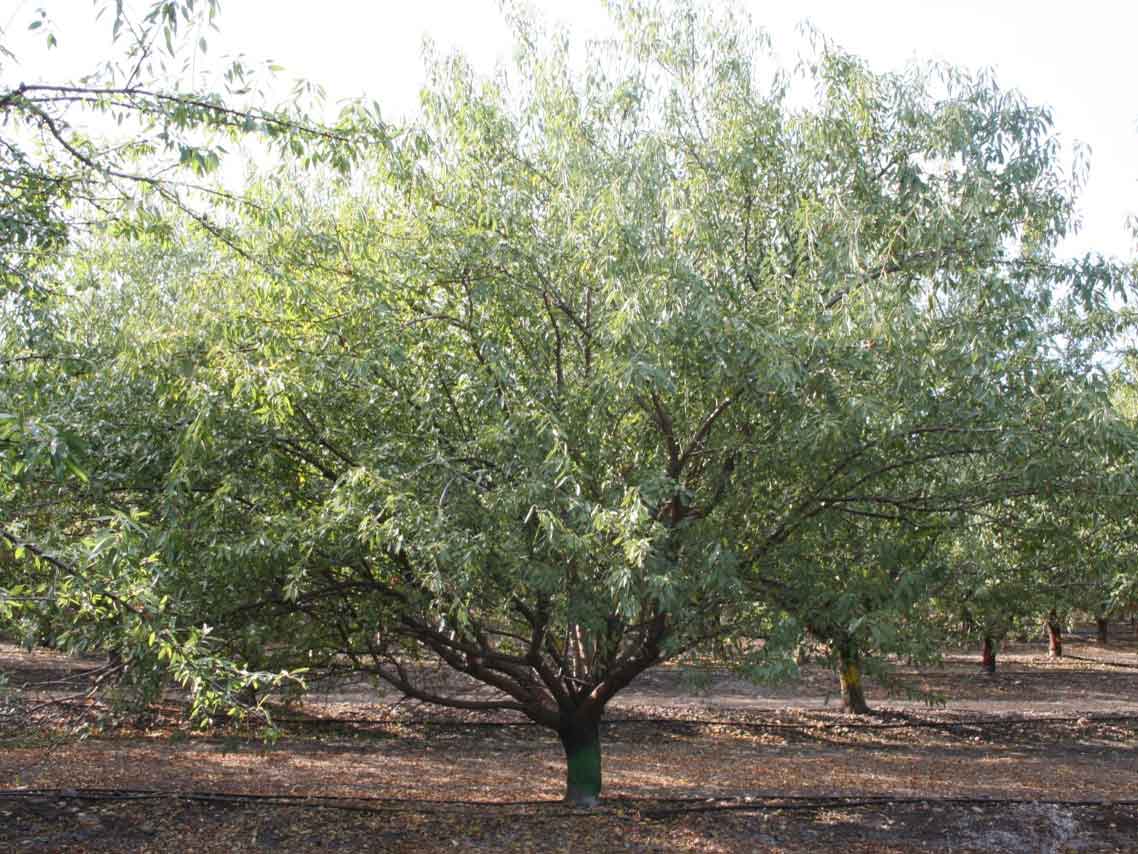
In practical use, light intercepted by the canopy during the solar noon (also known as the incoming Fractional PAR (fPAR)) is determined by measuring the PAR below and above the tree and presented as a percentage. The size of the tree’s shadow on the ground at the solar noon is also an indication of fPAR. Measuring fPAR can provide growers with an accurate estimation of canopy biomass. Previous studies showed that fPAR is the most important factor determining the maximum amount of dry kernel yield (potential yield) that an almond orchard can theoretically produce under an optimum condition (no stress, no extreme weather, no pest/disease and desired bee activities.)
A mobile lightbar platform was previously developed at UC Davis and has been commonly used for measuring fPAR in mid-season and predict potential yield in almonds. It includes an array of light sensors mounted on a horizontal bar and carried by a gator vehicle under the canopies and in every row of an orchard at the solar noon. The analysis of 10 years of lightbar data in California showed that a mature almond tree could produce up to 58 pounds of dried kernel yield per acre for each 1% of fPAR intercepted by the canopy. Although ground measurement of fPAR is useful for predicting potential almond yield, it’s not the most efficient approach because it needs to be done only at the solar noon (midday), it’s not widely available for large-scale commercial scanning, and it requires technical expertise for data collection and processing.
Virtual Orchard Results
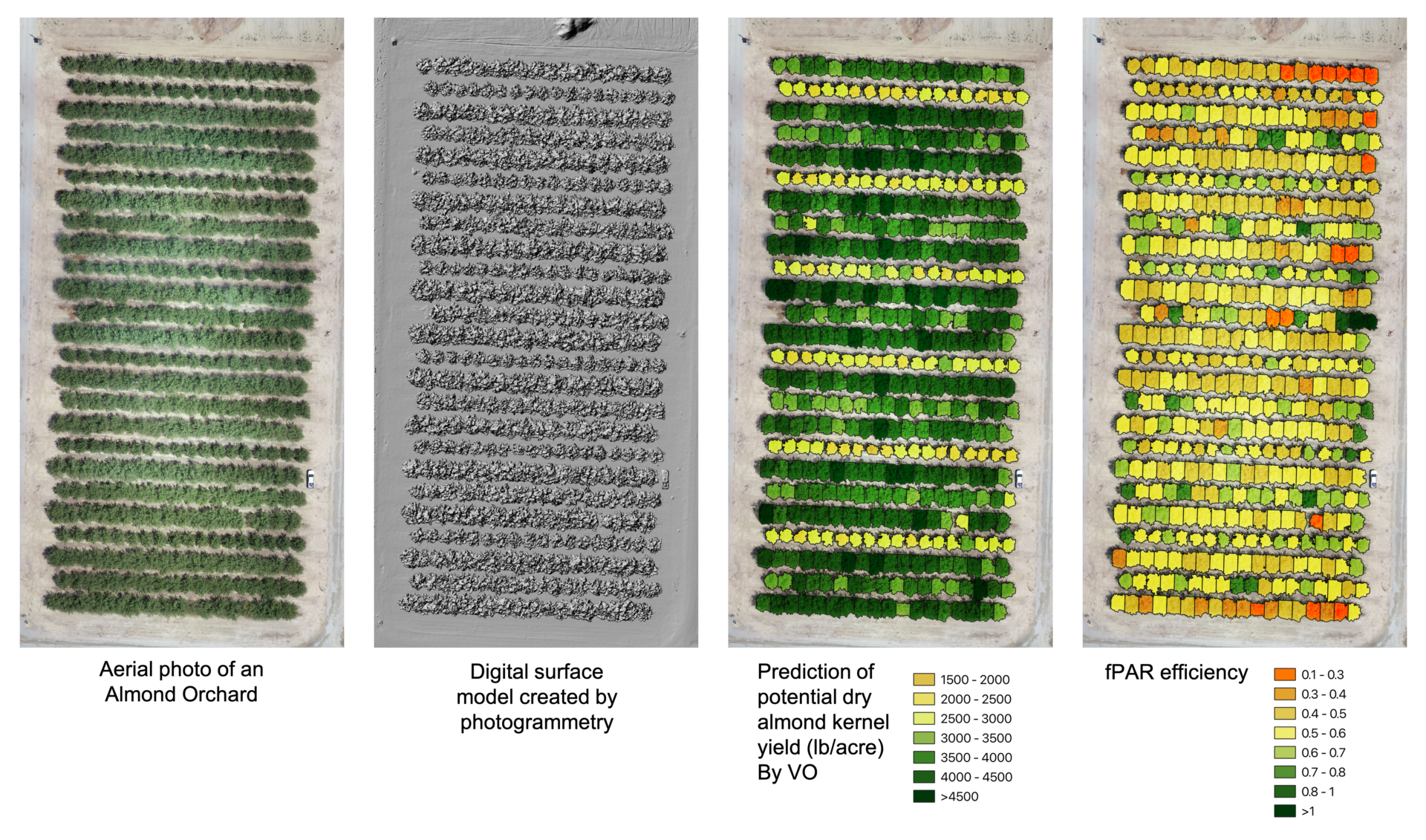
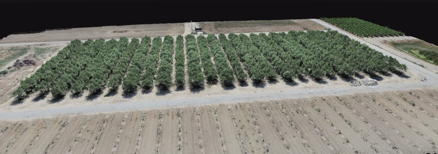
At the digital agriculture lab at UC Davis, we developed a drone imaging technique called Virtual Orchard (VO) to scan and generate 3D models of orchards and accurately estimate fPAR with tree-level precision. We use small and affordable unmanned aerial quadcopters (equipped with RGB cameras) as well as a flight mission planner application (both are commercially available off-the-shelf, and the planner app tool can be used for free) to automatically collect aerial RGB imagery from an orchard at any time of the day, while fPAR measurement by the lightbar platform has to be done only during the solar noon. We process the aerial imagery with a photogrammetry technique to generate a point cloud reconstruction of the orchard (3D model). The VO algorithm then processes the 3D point cloud and estimates fPAR.
Our evaluation confirmed that fPAR estimated by the VO technique strongly correlates to fPAR measured by the lightbar platform (near 1:1 ratio), particularly for Nonpareil, which is California’s leading variety. In a research project funded by the Almond Board of California, we monitored temporal canopy changes of 1,440 individual mature almond trees in eight different varieties such as Nonpareil, Monterey, Wood Colony, Butte, Carmel and Lonestar and two ages (6- and 11-year-old trees) from May to August during the 2019 season.
We also measured dry kernel yield per tree and conducted a statistical analysis to determine the accuracy of yield prediction by fPAR at different growth stages. The drone-based method could predict Nonpareil dry kernel yield with a mean error of 227 lbs/acre in May, 199 lbs/acre in June and 195 lbs/acre in July; all were below the standard deviation (or data variations) of the row-level yield data (~500 lbs/acre). The VO method using drone imagery could predict Nonpareil almond yield with significantly higher accuracy than the lightbar platform. Also, VO technology offers more precision at the tree-level, which is not available with the lightbar platform.
Radiation-use efficiency is defined as “the ratio of dry matter produced per unit of radiant energy used in its production.” We can calculate radiation-use efficiency for nut crops by the ratio between actual dry kernel yield and potential yield estimated by the lightbar model. Since mapping an orchard by a drone will provide tree-level precision, individual trees’ productivity can be determined using the actual yield data. Early forecasting of (potential) yield as a decision support tool enables growers to have a more accurate estimation of the seasonal nitrogen demand and make better decisions for irrigation frequency and rate.
Grower Adoption
Drone technology has grown exponentially in the past few years; today, the drone market offers more affordable prices, better imaging quality, safety/control options and more comfortable use. Many of these inexpensive drones can collect the aerial imagery required by the VO method for early yield forecasting. Tree-to-tree variations can be monitored accurately during the season and used for precise management of nitrogen and water. At the digital agriculture lab, we periodically provide hands-on training on using commercially available drones for collecting aerial data (as well as introducing other accessible processing tools or sensors on aerial imagery) to deliver hands-on experiences and educations to the growers.
Training and consulting services for data collection will be provided to growers interested in adopting VO technology. A web application platform (myvirtualorchard.com) was created as a decision support tool to facilitate the data processing and analytics pipeline. Raw aerial RGB imagery collected using any drone (with our instruction) can be uploaded to the cloud, where 3D model generation and analytics are conducted in the server and the output is delivered as Excel/PDF reports or interactive online maps. The results include per-tree information such as PAR, tree size (height, area and volume), estimation of potential yield, prediction of actual yield, fPAR productivity and nitrogen and irrigation rates.
Drone imaging and Virtual Orchard technology for precise orchard management have become more promising and reliable by integrating multi-year and multi-location data collected across the state into the decision support tool. In the digital agriculture lab, we collect and analyze annual aerial and ground truth data from several nut orchards to determine and document canopy growth under various management practices and improve the yield prediction model. Nut growers will benefit by forecasting (potential) yield early in the season when optimum orchard management can still be achieved using the Virtual Orchard decision support tool.


